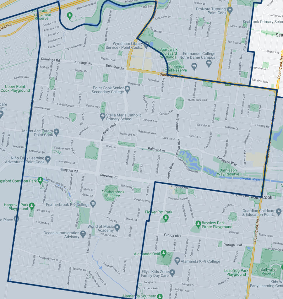
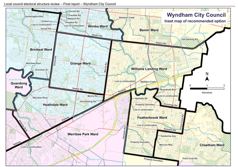
Featherbrook Ward, found within Point Cook. The Ward of Wyndham City Council is bounded by Hacketts Road, Skeleton Creek, Boardwalk Boulevard, Point Cook Road and Sneydes Road. It covers an area of 8.8 square kilometres.
It has has 18,079 registered electors (as of July, 2023).
The ward name (from the Electoral Representation Advisory Panel’s recommended electoral structure) was based on the name of the street, school, park, community centre, kindergarten and shopping centre in the ward, all having the name “Featherbrook”.
If you are not sure if your home is in this Ward, this website will help – https://maps.vec.vic.gov.au/

When creating the structure of Wards in Wyndham, the panel wrote:
In October 2022, the Minister for Local Government formed 2 electoral representation advisory panels to review and provide advice on the electoral structures of 39 local councils, under section 16 of the Act. If the Minister accepts the electoral structure recommended by the panel, any changes will take effect at the October 2024 local council elections. The Act introduced several changes to local government representation, including the types of electoral structures local councils may have. All metropolitan, interface and regional city councils (including Wyndham City Council) must now have single-councillor ward electoral structures.
As population changes affect voter numbers and distribution in subdivided local councils, one or more wards may be unlikely to meet this requirement at the next general election. In such circumstances, the VEC recommends adjustments to internal ward boundaries to ensure that all wards meet the equality requirement before the next election and ideally, until the next scheduled electoral representation review.
The electoral representation advisory panel recommends that Wyndham City Council adopt an 11 single-councillor ward structure – 11 wards with one councillor per ward. The recommended names for the 11 wards in this electoral structure are Bemin Ward, Brinbeal Ward, Cheetham Ward, Featherbrook Ward, Grange Ward, Heathdale Ward, Iramoo Ward, Quandong Ward, Werribee Park Ward, Williams Landing Ward and Wimba Ward.

We all know Wyndhams population is exploding. So a review was undertaken, leading the Wards we have now, Featherbrook Ward is one of 11 new wards in Wyndham City Council.
Located in Melbourne’s outer western suburbs, halfway between Melbourne and Geelong, Wyndham City Council covers an area of 542 km2. It is bordered to the south-west by Greater Geelong City Council, to the north-west by Moorabool Shire Council, to the north by Melton City and Brimbank City councils and to the east by Hobsons Bay City Council.
In the south the council area includes the localities of Werribee South and Cocoroc and to the east are Point Cook, Williams Landing, and part of Laverton. Along the northern council boundary are Laverton North, Truganina, Tarneit, and part of Mount Cottrell. The established areas of Werribee and Hoppers Crossing are in the centre of the council area. Wyndham Vale and Manor Lakes, and the less populated areas of Mambourin, Quandong, and parts of Eynesbury and Little River are in the west. The Traditional Custodians of the land in Wyndham City Council are the Bunurong and Wadawurrung peoples.
Wyndham City Council contains major transport routes connecting Melbourne with Geelong and regional Victoria, including the Princes Freeway and two train lines. The Werribee train line consists of the suburban line that finishes at Werribee and the national freight line that traverses the council from east to west. The regional train line extends around the north and west of the established areas and connects into the Werribee train line south-west of Werribee. The Werribee River flows through the council area and there are a number of waterways and wetlands, including Skeleton Creek and Cheetham Wetlands.
Urban development is limited by the urban growth boundary around the north-western, western and southern parts of the council area (DTP 2023). Land inside the boundary contains established residential areas and large areas of former agricultural land being subdivided for new residential development.
As one of Australia’s fastest growing local council areas, Wyndham’s population is forecast to grow at a rate of 3.4% per annum from 2022 and 2028. The population is expected to reach over 500,000 by 2041 (.id 2022c). It is important, in my view, that council provides meaningful leadership given this growth.
